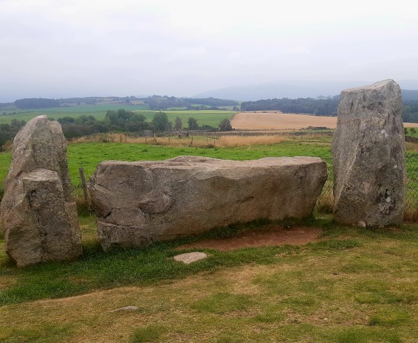
I happened upon this stone circle when I’d come to find nearby Culsh Earth House. Thought to have been built around 5,000 years ago, this is one of several stone circles unique to the north-east of Scotland as it has a recumbent stone. Framed by the recumbent stone the stones flanking either side, the focus of this circle seems to have been Lochnagar, the prominent mountain 20 miles(32km) south-west of here. The Neolithic people who built this circle would have used it to mark the movement of the Moon throughout the year. They undoubtedly linked the landscape and the stars with their spiritual life and would have revered this site as a place of worship. Set upon this wee hill at the centre of these flatlands known as ‘the Howe’, it’s likely that other communities and their stone circles would also have been visible from here.
The centre of this particular circle, surrounded by kerb stones, is known to have been used for cremation pyres. A mound of charcoal, burnt soil and bone was excavated from the centre here in the 1990’s.
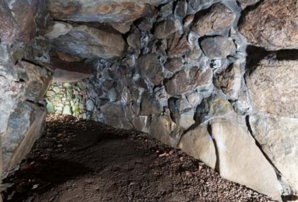
Built about 2,000 years ago, and despite its name, it was not a dwelling, but a 15m stone-lined, underground passage. This Iron Age larder is one of the most complete examples of its kind.
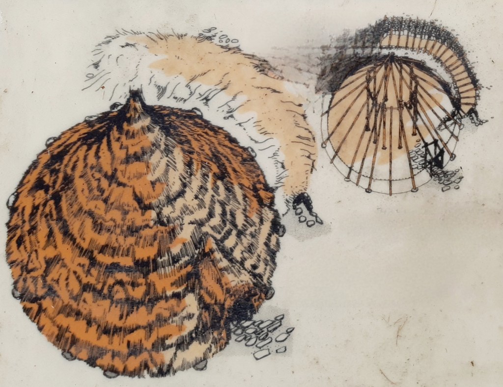
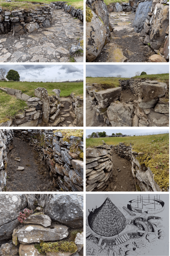
Culsh earth house survives as it was over 2,000 years ago and is one of only a few souterrains in Scotland that can safely be accessed. We don’t know what it was used for – perhaps a storage space, potentially a hiding place, or as two cup-marked stones inside may indicate it may have had some ritual significance. From the outside this souterrain appears to be just a bump in the ground therefore it would not have attracted any attention, It could, however, be entered both from within the round-house built above it and from the concealed outside entrance.
Check out other examples of Scottish souterrains such as those at – Tealing, Ardestie and Carlungie.
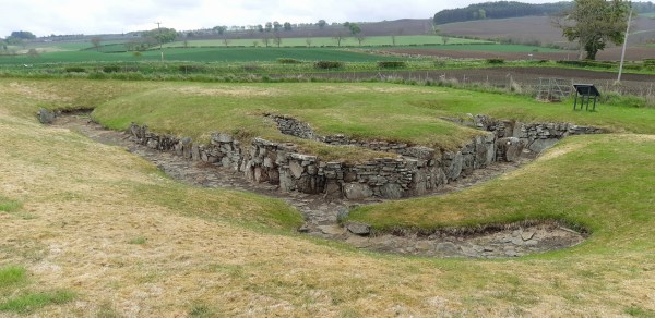
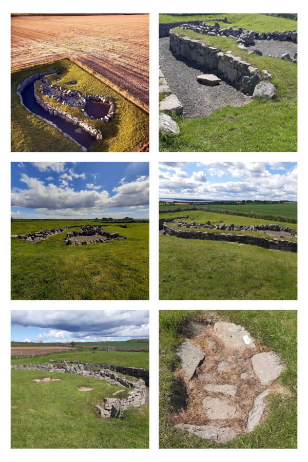
At about 40m long, Carlungie Earth House is one of the largest and most complex examples of its kind in Scotland. It was accidentally discovered during ploughing in 1949 and subsequent excavations during the following two years revealed a further eight associated stone dwellings at ground level.
Earth houses, or souterrains as they are also known, were once thought to have been defensive refuges but it’s now considered that they were in fact cellars, as their cool environment would have made them suitable for storing grain, dairy products and meat. These stone-lined underground passages typically date to the Iron Age and have been found along much of eastern Scotland, as well as in Ireland, Cornwall and Brittany. Just a few miles away can be found Ardestie and Tealing ‘earth houses’ and farther north Culsh Earth House just outside Tarland, Aberdeenshire.
The remains of Ardestie Iron Age souterrain was uncovered during stone clearance in 1949. Structures like this formed part of many Iron Age farming settlements north of the River Forth, sometime between 2,800 & 1,500 years ago. Life here centred around farming so the use of these souterrains may have been for storing grain and other goods however they were vulnerable to dampness and vermin. This souterrain was adapted after it was built, by putting in a stone lined drain to combat its poor drainage.
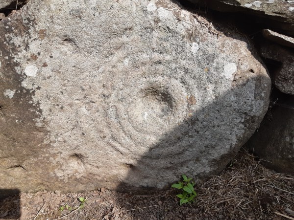
Souterrains such as this were skilfully built and often had cup marks and symbols on some of the stones. It could possibly mean that they also had a ritual function such as for rites of passage.
If you have an interest in these ‘earth houses’, you can visit others nearby at Carlungie and Tealing, then further north Culsh Earth House by Tarland in Aberdeenshire
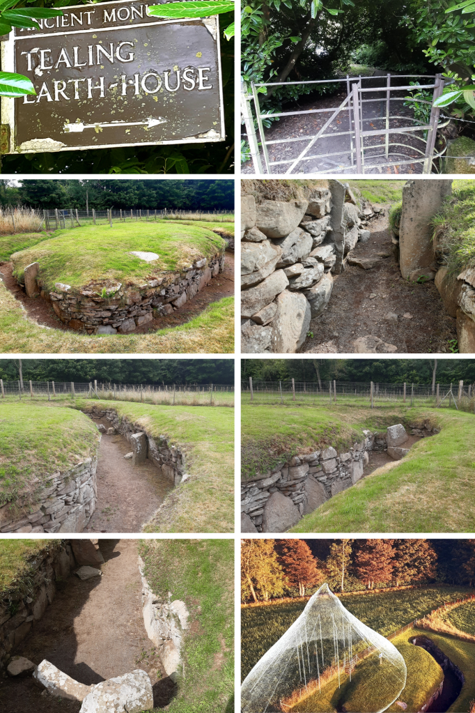
It’s amazing the things you come across by chance. I was driving north to Aberdeen when I noticed the signpost for this place, so intrigued, I stopped by to check it out….and what a fantastic find!
This isn’t actually an ‘earth house’ but an Iron-Age souterrain, a subterranean passage that was originally roofed over with stone slabs. A small room at the end of the chamber here had been created by a pair of huge, up-right slabs. It was discovered in 1871 while a local farmer was ploughing the field here. Souterrains can be found around Scotland’s eastern coast and built around 2,500 years ago, they would have been part of farming settlements made up of clusters of timber roundhouses. Souterrains seem to have been accessed from within a roundhouse built above, providing a cool dark place, most probably used for storing food. They would, however, have been vulnerable to dampness and vermin. They could also have been used as places of refuge if the settlement was under attack. As you can see from the stone-walling, this was skilfully built and may have incorporated a symbolic function. Here at Tealing, pre-historic rock art is carved into one of the huge stones by its entrance. The cup and ring marked stone perhaps represents the sun, the portal to a spirit world, even life itself, or life beyond this realm – eternity.
Excavation at Tealing found animal bones, shards of pottery, broken grinding stones for wheat and fragments of Roman glassware, the latter, suggesting trade routes with distant places. It could also mean this souterrain might still have been in use when the Romans passed through here. Only a few miles East of Tealing a further two Souterrains can be found – Ardestie & Carlungie while another, Culsh Earth House can be found near Tarland in Aberdeenshire.
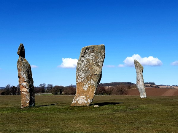
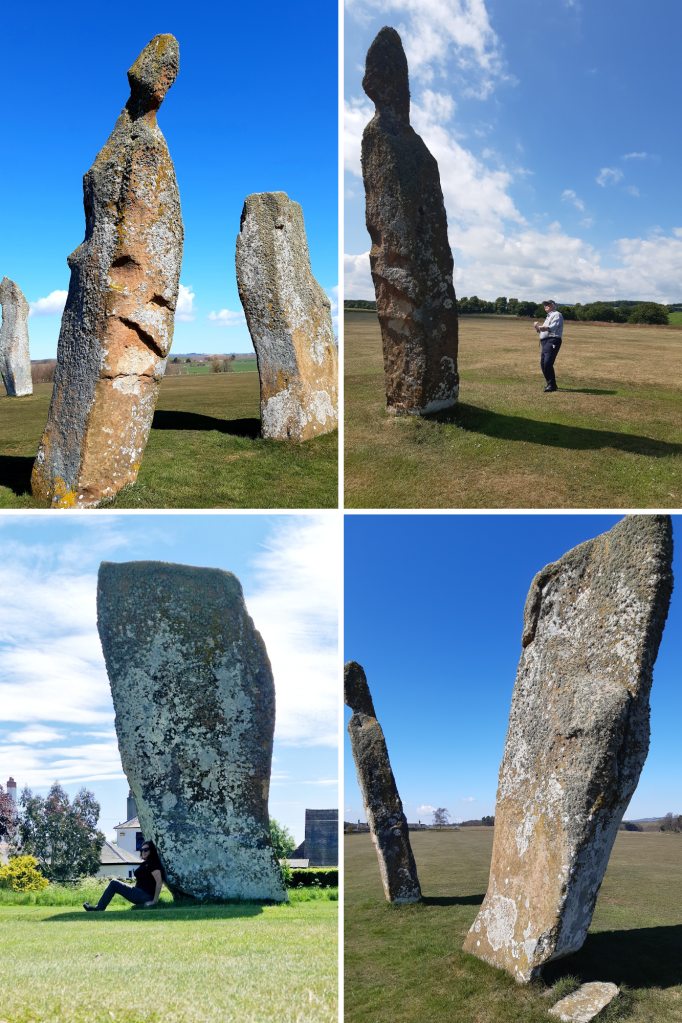
Where once where there were four, now there remains three very impressive, irregularly shaped, red sandstone megaliths. They are thought to have originally been part of the 16M circumference of a complete stone circle from the bronze age, 2000 – 1500BC. It’s said that the missing fourth stone had been broken by treasure hunters, the base remaining with the broken upper lying nearby until 1792. It was then moved by a farmer to allow for better ploughing of the field and was subsequently lost to memory.
A stone lined grave (cist) containing a skull was discovered near the Lundin stones in 1844. The skull, was given to Prof of Anatomy at Edinburgh University, Sir William Turner, who reported it had a metal arrowhead imbedded within a fracture but this crumbled to rust when it was touched. The discovery of the ‘ancient sepulchre’ draws parallels with other standing stone sites in Fife where human remains were also found.
Local folklore tells that the Lundin stones were memorials to Danish Chiefs who had been slain during a great battle here. However, these days the stones are witness to nothing more belligerent than golfing competitions as they present a magnificent feature on the second fairway of Lundin Links Ladies Golf Course.
The stone sitting south east, has a height of 4.2M with a slight northward incline. This one is heavily weathered, pitted with a large crack that has developed on its east side. The south stone is 4.6M in height and decidedly inclined southward. Lastly, the north stone is the tallest at 5.1M, having a slight incline westward. Bear in mind that in order for these stones to remain standing they will need be seated into the ground to equivalent lengths
I’ve come here many times with family or friends who’ve had an interest in Scotland’s ancient history and they’ve all been impressed with the magnitude of the Lundin Stones and the fact that they still remain after all this time. If you decide to visit, please be polite by asking at the Club House if it’s safe to walk to the stones as there may be golfers about to tee off. Be sure to also skirt the course on your way to and from the site. A blow to the head with a golf ball could mean your skull might be the next to leave here with a fracture!
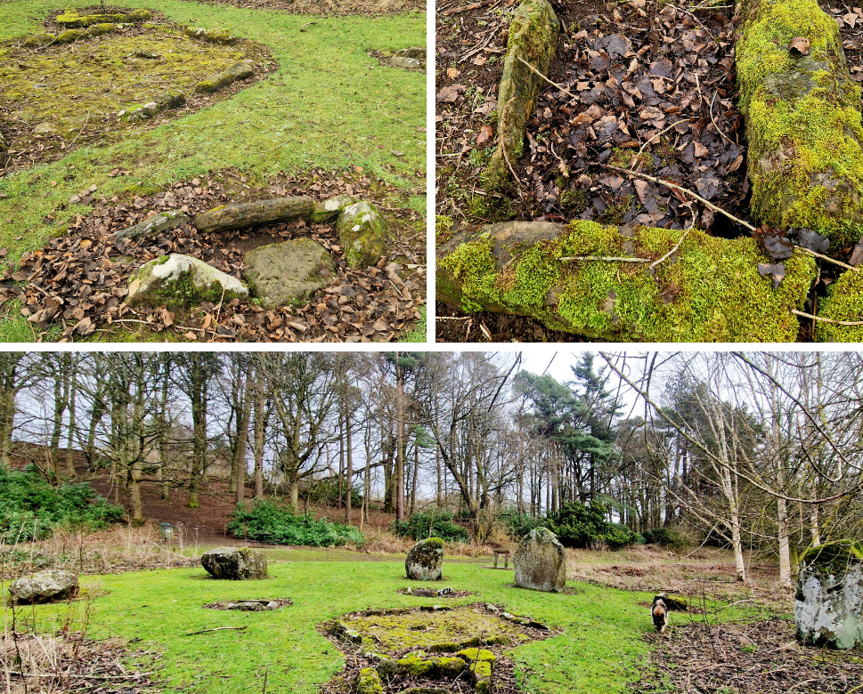
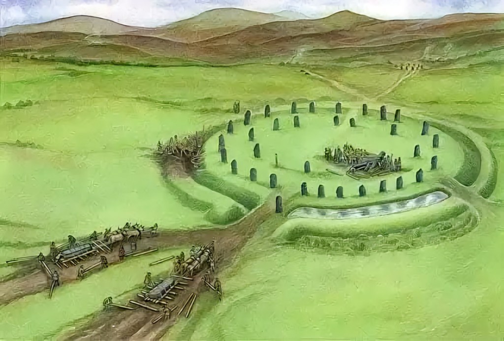
Located on the outskirts of Glenrothes in Fife, Balfarg Henge is now incongruously surrounded by a modern housing estate. Encircled by hills, this was once a revered landscape and main centre of ritual, sacred to generations of prehistoric people. While there are only two of its original stones remaining and sadly, a rather underwhelming place to visit these days than other Neolithic monuments in Scotland, (such as Calanais in Lewis or Ring of Brogdar in Orkney) 4,000 years ago Balfarg Henge would have been equally as evocative. The ceremonial, circular enclosure, measuring 60 metres across (known as a ‘henge’), was formed by a bank with an internal ditch and encompassed temples for the living and graves for the dead. Evidence of ritual feasting, sacrifice, smashed pottery and human burial were found here and at the centre of the henge, lying level with the grass, is a massive stone slab which covers a stone cist, containing the remains of a teenage boy from that period.
The nearby Balbirnie Stone Circle was excavated then moved when the current main road was widened. It originally had been only 300 metres from Balfarg Henge, in a much more prominent position with the circle facing the midsummer sun rising over Clatto Hill. It had a hearth at its centre, perhaps for lighting up night-time ceremonies. Communities would have gathered here to celebrate seasonal festivals and to honour their ancestors. Balbirnie became a place of burial where the cremated bones of women and children were placed in stone cists, along with precious objects.
Neolithic peoples cleared woodland and introduced agriculture to Fife around 6,000 years ago. They were also hunter-gatherers, moving from place to place throughout the year as seasons changed. The efforts made by these people to build shared sacred sites like Balfarg and Balbirnie affirms that their society was sophisticated and organised.