Tomb of Robert Munro Ferguson – Kirkcaldy, Fife

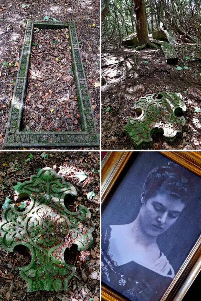
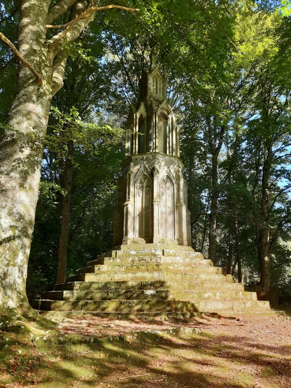
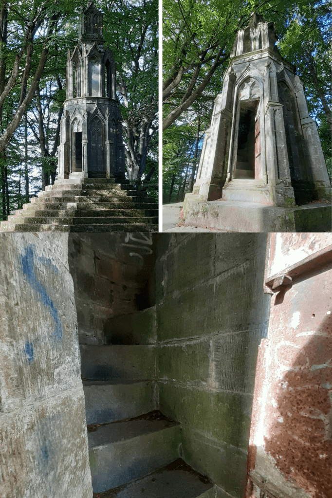
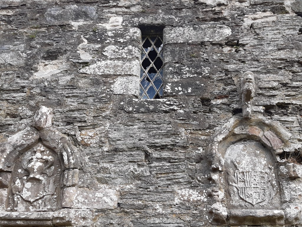
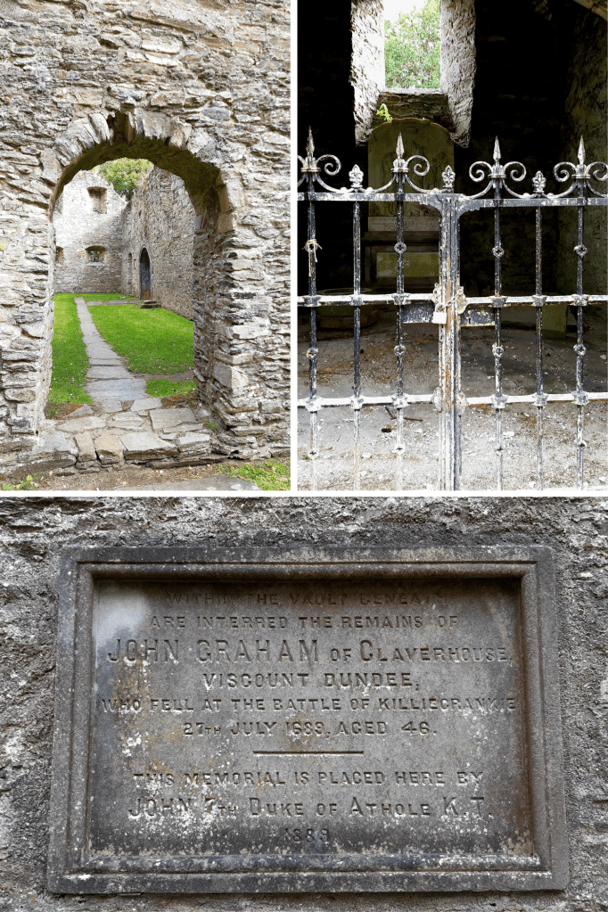
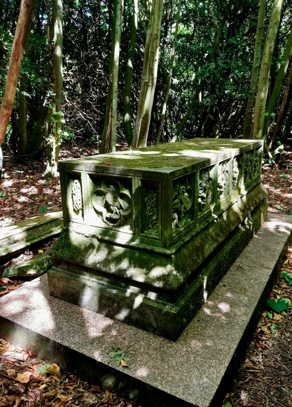
In an overgrown tangle of trees on a hill in the Raith Estate, on the outskirts of Kirkcaldy, there’s a long forgotten tomb. This is a place only visited by the occasional dog walker and teenagers searching for a bit of woodland adventure. Millie didn’t care that it took a while to find the location and what a magnificent resting place this would have been, once upon a time, when it overlooked Raith Lake and the surrounding rolling hills.

This is the Tomb of Lieutenant Robert Munro Ferguson, an officer of the 79th Regiment of Foot who became Colonel of his Regiment, commanding from 1835 to 1841. He was born on 20th August 1802, grew up in Muirton in Fife then went on to study in Edinburgh. Robert was the son of Ronald Craufurd Ferguson (also Colonel of the 79th from 1821 to 1841) and was appointed commanding officer with the rank of lieutenant-colonel on 13 March 1835, thus commanding in the regiment under his Father. The regiment had been serving in Canada but returned to Scotland in 1836.

On retiring from the army, Robert got into politics and became Liberal MP for Kirkcaldy Burghs from 1841 to 1862. He wholeheartedly supported the Liberal agenda, wanted electoral reform, male suffrage and the secret ballot, supported triennial fixed parliaments, voted for revision of Corn Laws and income tax. He also voted for universal, free schooling. Robert was re-elected unopposed at 4 consecutive general elections.

On 17th May 1859 he married Emma Elizabeth Mandeville at Westminster in London and they went on to have six children together: Ronald Craufurd, Alice Edwina, Emma Valentine, Hector, Robert Harry & Edith Isabel. In 1864 Robert inherited the baronies of Novar in Ross and Muirton on condition of adding ‘Munro’ to his surname. He died on 28 November 1868 and was laid to rest here.

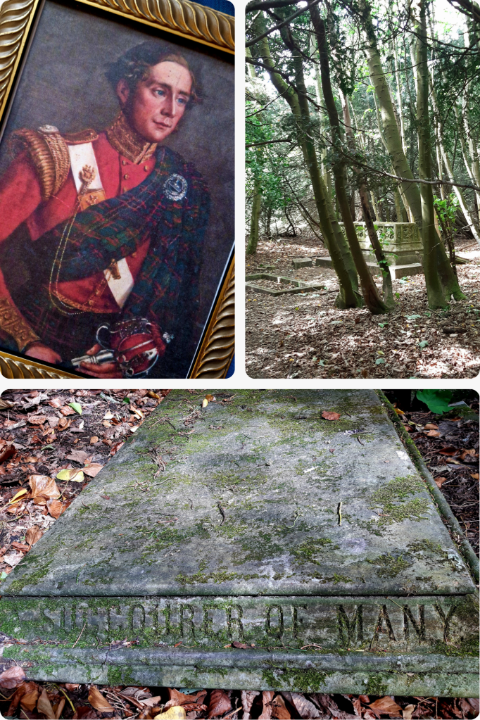
The slab from the top of his tomb now lies unceremoniously, toppled to one side and the inscription around its rim reads: Robert Munro Ferguson of Raith & Novar. Lieutenant Colonel of the 79th Highlanders. Born 20th Aug 1802, Died 27th November 1868, Succourer Of Many.

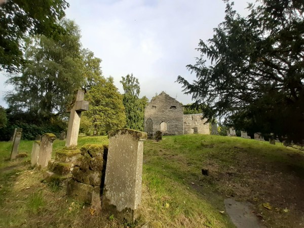
His daughter, Emma Valentine, also held her father’s liberal views, was in favour of women’s suffrage and is known to have created a leaflet entitled ‘Union of Practical Suffragists within the the Women’s Liberal Federation’. In 1890 she became engaged to Scottish born politician, Richard Burdon, Viscount Haldane, but for reasons I haven’t been able to ascertain, she broke off the engagement. Sadly, Emma died at the age of 34 years and was laid to rest here alongside her Father. The beautifully intricate, now broken cross lying in pieces on the slope was in memoriam of her as the base bears her name. The inscription around her grave is still legible and says: Valentine. Born Feb 14 1863. Died Sep 14 1897. Until The Day Dawn.

Dunfallandy Stone – Pitlochry, Perthshire

I’d heard about this magnificent stone so finally took the time to stop off to search for it while heading to the Cairngorms. Once you get into Pitlochry it’s actually quite well signposted however there isn’t really much parking nearby so I left the van in town and Millie and I enjoyed a stroll (for the most part) out past the caravan park and along the road to get there. It’s quite a narrow road without pavement and the drivers of a couple of Range Rovers that passed me seemed to think they were in a formula 1 race so Millie and I were forced into the ditch a couple of times. Do take care.

The Dunfallandy Stone is an elaborately carved Class II Pictish stone which is more than 1200 years old. To protect it from the elements, it has been enclosed in a shelter but disappointingly, reflections on the glass make it difficult to see and photograph. Non reflective glass would certainly have been a better option here.

Reminiscent of intricately decorated Pictish jewellery, this cross-slab once marked a place of prayer and is set in its original location, prominently on a mound known to have been topped by a chapel, where it would have been seen by all that passed by. The relief carvings show the sophistication of Pictish culture, mixing influences from across the British Isles and Europe with local traditions and belief. Typically, the body of the Cross is decorated with the familiar intricate Pictish knotwork.

It’s thought that stones such as this one were once coloured, using mineral pigments such as yellow ochre, red lead and green verdigris, emulating the style of metalwork and religious manuscripts of the time. The images on the front depict Pictish monsters (considered agents of God’s wrath), a stag, Jonah being swallowed by a whale and angels. On the reverse side, depictions are of enthroned bishops or saints facing each other, a rider representing perhaps the patron who commissioned the stone then at the bottom are Iron-working tools (tongs, hammer, crucible). There are also several distinctively Pictish symbols on the reverse here, the Pictish monster, double disk and the crescent with v-rod however their true meaning is now lost to us.

Dunfallandy Stone now shares the mound with burial enclosures surrounded by railings. One of these is the site of the impressive tomb of Lieutenant-General Archibald Fergusson of Dunfallandy who died in 1834. This, I assume would be why the location was referred to as Mausoleum Mound from the 1860’s.

The Eleanor Cross – Kenmore, Perthshire

I’d parked overnight in a layby at the east end of Loch Tay at Kenmore and took a swim in the morning sunshine alongside several other morning dippers. Slipping into the cool, clear water of the still loch was a refreshing way to wash away the remnants of sleep. Meanwhile, Millie danced around at the waters’ edge desperate for me to come out. She’s a paddler not a swimmer.

I’d brought my Children camping to Kenmore over the years so it evoked happy memories to be visiting again. There are lovely walks around this area and so Millie and I set off on a jaunt through the woods to take in the Eleanor Cross and onward towards Aberfeldy. The pathway starts by the bridge at the mouth of the Loch and meanders along the north side of the river for a while then heads up the hill through the woods. The Cross was commissioned in 1831 by Lord Breadalbane in tribute to his beloved wife Mary. At that time it would have had a view of the hills and down along the valley with beautiful vistas of the River & Loch Tay. In all these many years however the woodland has grown up high into beautiful mature trees with birdsong echoing through them.

Eleanor Cross is built on the site of an old summer house known as Maxwell’s House. It stands 30 feet tall with a 9 step octagonal base encircling it, a cruciform mid section and a square pinnacle top surmounted with a cross. Delightfully, a door on its south side opens to a spiral stairway. This leads to a small open-air arched gallery surrounding the structure. Climbing up the steps, it feels like a childhood adventure to reach the platform and look through the trees at height. Sadly the interior has been sprayed with graffiti: evidence of bored minds and idle hands.

A brass plaque acclaims – This Building is Dedicated to my Faithful Friend and Fellow-Labourer, MARY, COUNTESS OF BREADALBANE, whose maternal care has been extended to all around this place. anno domini, 1831.

I’ve been as yet unable to ascertain why this particular monument was named ‘Eleanor Cross’ so for the moment will surmise that the reason was purely a romantic gesture in keeping with Breadalbane’s status and the era. (The Victorians were fond of building ornamental ‘follies’ and they can be found throughout Scotland in beautiful rural settings.) NB: King Edward I of England had twelve Eleanor Crosses erected as markers built along the funeral route taken by his wife Queen Eleanor of Castile. They marked the nightly resting places of her coffin procession from Lincoln to Westminster Abbey in 1290.

St Bride’s Kirk – Old Blair by Blair Atholl

Reaching this 16th century Kirk takes in a lovely walk northward past Blair Castle, through ancient and varied woodland, including exotic Cedar and Sequoia trees, to a clearing on a mound. The Kirk lies where once was the village of Old Blair through which the old Perth to Inverness road used to run. The fabric of this existing structure dates back to around 1560 however its origins are rooted in Celtic times, standing on a raised circular mound, built over earlier churches possibly dating as far back as the dark ages.

Surviving records show that in 1275 when Scottish Churches were required to finance the crusades, St Brides made payments of 32 shillings which was a significant amount in those times. In 1475 Angus Og, the son of John MacDonald II, Lord of the Isles, attacked Blair Castle. The Earl and Countess of Atholl took refuge in the Kirk but were taken prisoner by Angus who sacked and damaged the building. While sailing back to Islay, Angus’ ship was nearly lost in a violent storm and this was interpreted as retribution for what he’d done to the Kirk. It’s told that he immediately returned to Blair Atholl where he paid for repairs to St Bride’s to try to make amends with God for his actions.

The Coat of Arms of the 4th Earl of Atholl and his 2nd wife were mounted on the outside of the Kirk in 1579.

On 27 July 1689, John Graham of Claverhouse 1st Viscount Dundee (known as ‘Bonnie Dundee’) led his Jacobean army against General Hugh McKay’s Government forces at the Battle of Killiecrankie. Victory was on the the Jacobites side that day, however, amongst the many casualties Dundee himself was mortally wounded. Three days after his death his body was carried here to St Bride’s where he was buried in the vault beneath the South Aisle Mausoleum. Sadly, the vault was broken into in the 1790’s and Dundee’s armour was looted and sold as scrap. The breastplate is the only item remaining and is now on display in Blair Castle.

In 1824, the village of Blair Atholl built its own Church so St Bride’s gradually fell into disrepair. The 6th Duke of Atholl was buried here in 1864 then also his wife Countess Anne in 1897. The remains of other family members were reinterred to the West of the Kirk from and earlier family cemetery in 1954.

Arbroath Abbey, Arbroath – Angus

As you walk into the heart of the city of Arbroath, you get a feeling of the enormity that this Abbey once was. Impressive parts of this red sandstone cruciform Church still survive, the west end, south transept & sacristy, the gatehouse and the Abbot’s house which is now the museum. The cloister and other buildings are now ruinous but their foundations are still apparent and there’s also a large cemetery within the grounds.

Arbroath Abbey was founded in 1178 by King William (1st), the Lion, for the Tironensian Benedictin Monks from Kelso Abbey. King William bestowed considerable lands and great wealth upon the Abbey as well as custody of the Monymusk Reliquary, the casket believed to contain the relics of St Columba. It’s believed that he had the Abbey built in memory of his murdered dear friend, Thomas Becket (St Thomas the Martyr) and in the hope of currying favour with God for his own safety. William had been captured by English forces at the Battle of Alnwick in 1174 and only released by King Henry II a year later after being forced into signing the Treaty of Falaise which acknowledged Henry as William’s feudal superior. William was eventually buried here in 1214.

The Declaration of Arbroath, asserting Scottish independence over English aggression, was signed here in 1320. The original document is in the keeping of National Records of Scotland however a copy can been seen in the abbey’s museum. In 1951 a group of students stole back Scotland’s Stone of Destiny from Westminster Abbey. It had been seized in 1296 by Edward I of England from Scone Palace (nr Perth) where all Scottish Kings were crowned upon it. Edward took the stone to demonstrate his power over Scotland. It was used in the coronation of British monarchs thereafter however this was hugely resented by Scots. The students eventually placed it at the High Alter of Arbroath Abbey. The Stone of Destiny is now currently on display at Perth Museum.

In the 1800’s Arbroath’s huge fishing fleet would look for the massive round window of the Abbey’s south transept gable to guide them home from the open sea. A red beacon fire was lit at the iconic window and this practice gave the people from Arbroath the nickname of ‘Red Lichties’ (red lights).

Tomnaverie Stone Circle, Tarland – Aberdeenshire

I happened upon this stone circle when I’d come to find nearby Culsh Earth House. Thought to have been built around 5,000 years ago, this is one of several stone circles unique to the north-east of Scotland as it has a recumbent stone. Framed by the recumbent stone the stones flanking either side, the focus of this circle seems to have been Lochnagar, the prominent mountain 20 miles(32km) south-west of here. The Neolithic people who built this circle would have used it to mark the movement of the Moon throughout the year. They undoubtedly linked the landscape and the stars with their spiritual life and would have revered this site as a place of worship. Set upon this wee hill at the centre of these flatlands known as ‘the Howe’, it’s likely that other communities and their stone circles would also have been visible from here.

The centre of this particular circle, surrounded by kerb stones, is known to have been used for cremation pyres. A mound of charcoal, burnt soil and bone was excavated from the centre here in the 1990’s.

Culsh Earth House, Tarland – Aberdeenshire

Built about 2,000 years ago, and despite its name, it was not a dwelling, but a 15m stone-lined, underground passage. This Iron Age larder is one of the most complete examples of its kind.

Culsh earth house survives as it was over 2,000 years ago and is one of only a few souterrains in Scotland  that can safely be accessed. We don’t know what it was used for – perhaps a storage space, potentially a hiding place, or as two cup-marked stones inside may indicate it may have had some ritual significance. From the outside this souterrain appears to be just a bump in the ground therefore it would not have attracted any attention, It could, however, be entered both from within the round-house built above it and from the concealed outside entrance.

Check out other examples of Scottish souterrains such as those at – Tealing, Ardestie and Carlungie.

Carlungie Earth House – Angus

At about 40m long, Carlungie Earth House is one of the largest and most complex examples of its kind in Scotland. It was accidentally discovered during ploughing in 1949 and subsequent excavations during the following two years revealed a further eight associated stone dwellings at ground level.

Earth houses, or souterrains as they are also known, were once thought to have been defensive refuges but it’s now considered that they were in fact cellars, as their cool environment would have made them suitable for storing grain, dairy products and meat. These stone-lined underground passages typically date to the Iron Age and have been found along much of eastern Scotland, as well as in Ireland, Cornwall and Brittany. Just a few miles away can be found Ardestie and Tealing ‘earth houses’ and farther north Culsh Earth House just outside Tarland, Aberdeenshire.

Ardestie Earth House – Angus

The remains of Ardestie Iron Age souterrain was uncovered during stone clearance in 1949. Structures like this formed part of many Iron Age farming settlements north of the River Forth, sometime between 2,800 & 1,500 years ago. Life here centred around farming so the use of these souterrains may have been for storing grain and other goods however they were vulnerable to dampness and vermin. This souterrain was adapted after it was built, by putting in a stone lined drain to combat its poor drainage.

Souterrains such as this were skilfully built and often had cup marks and symbols on some of the stones. It could possibly mean that they also had a ritual function such as for rites of passage.

If you have an interest in these ‘earth houses’, you can visit others nearby at Carlungie and Tealing, then further north Culsh Earth House by Tarland in Aberdeenshire

Tealing Earth House, Tealing – Angus

It’s amazing the things you come across by chance. I was driving north to Aberdeen when I noticed the signpost for this place, so intrigued, I stopped by to check it out….and what a fantastic find!

This isn’t actually an ‘earth house’ but an Iron-Age souterrain, a subterranean passage that was originally roofed over with stone slabs. A small room at the end of the chamber here had been created by a pair of huge, up-right slabs. It was discovered in 1871 while a local farmer was ploughing the field here. Souterrains can be found around Scotland’s eastern coast and built around 2,500 years ago, they would have been part of farming settlements made up of clusters of timber roundhouses. Souterrains seem to have been accessed from within a roundhouse built above, providing a cool dark place, most probably used for storing food. They would, however, have been vulnerable to dampness and vermin. They could also have been used as places of refuge if the settlement was under attack. As you can see from the stone-walling, this was skilfully built and may have incorporated a symbolic function. Here at Tealing, pre-historic rock art is carved into one of the huge stones by its entrance. The cup and ring marked stone perhaps represents the sun, the portal to a spirit world, even life itself, or life beyond this realm – eternity.

Excavation at Tealing found animal bones, shards of pottery, broken grinding stones for wheat and fragments of Roman glassware, the latter, suggesting trade routes with distant places. It could also mean this souterrain might still have been in use when the Romans passed through here. Only a few miles East of Tealing a further two Souterrains can be found – Ardestie & Carlungie while another, Culsh Earth House can be found near Tarland in Aberdeenshire.

Blog at WordPress.com.

Up ↑