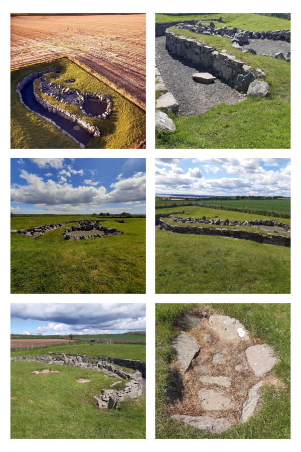
At about 40m long, Carlungie Earth House is one of the largest and most complex examples of its kind in Scotland. It was accidentally discovered during ploughing in 1949 and subsequent excavations during the following two years revealed a further eight associated stone dwellings at ground level.
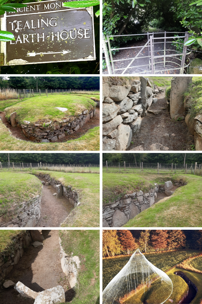
Earth houses, or souterrains as they are also known, were once thought to have been defensive refuges but it’s now considered that they were in fact cellars, as their cool environment would have made them suitable for storing grain, dairy products and meat. These stone-lined underground passages typically date to the Iron Age and have been found along much of eastern Scotland, as well as in Ireland, Cornwall and Brittany. Just a few miles away can be found Ardestie and Tealing ‘earth houses’ and farther north Culsh Earth House just outside Tarland, Aberdeenshire.
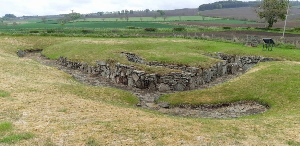
The remains of Ardestie Iron Age souterrain was uncovered during stone clearance in 1949. Structures like this formed part of many Iron Age farming settlements north of the River Forth, sometime between 2,800 & 1,500 years ago. Life here centred around farming so the use of these souterrains may have been for storing grain and other goods however they were vulnerable to dampness and vermin. This souterrain was adapted after it was built, by putting in a stone lined drain to combat its poor drainage.
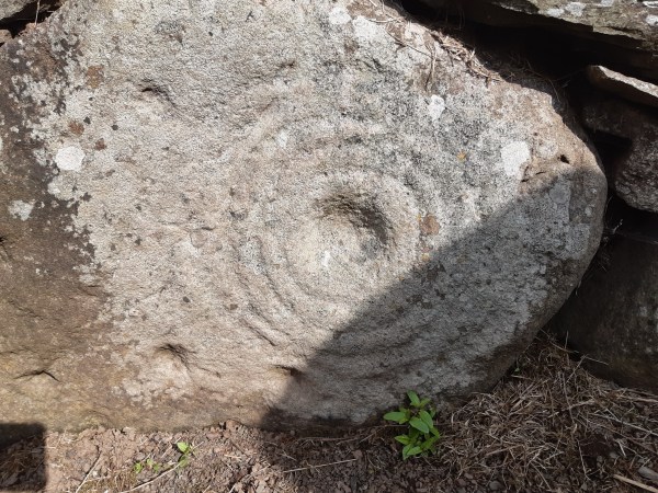
Souterrains such as this were skilfully built and often had cup marks and symbols on some of the stones. It could possibly mean that they also had a ritual function such as for rites of passage.
If you have an interest in these ‘earth houses’, you can visit others nearby at Carlungie and Tealing, then further north Culsh Earth House by Tarland in Aberdeenshire
It’s amazing the things you come across by chance. I was driving north to Aberdeen when I noticed the signpost for this place, so intrigued, I stopped by to check it out….and what a fantastic find!
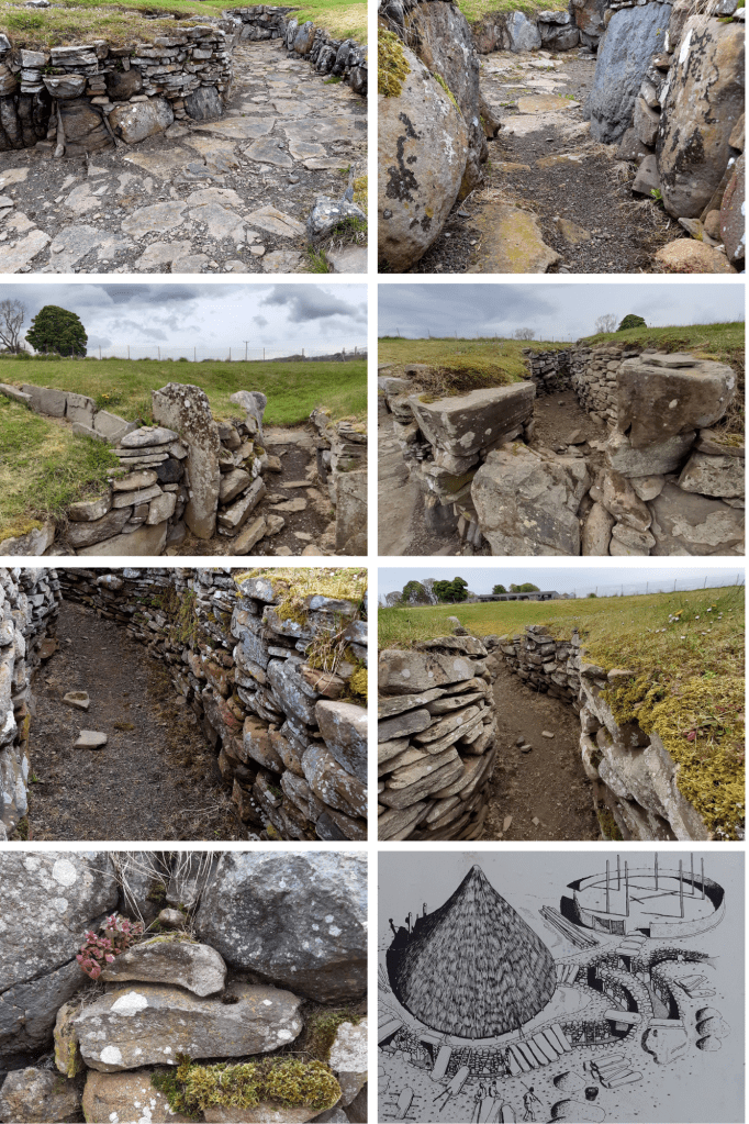
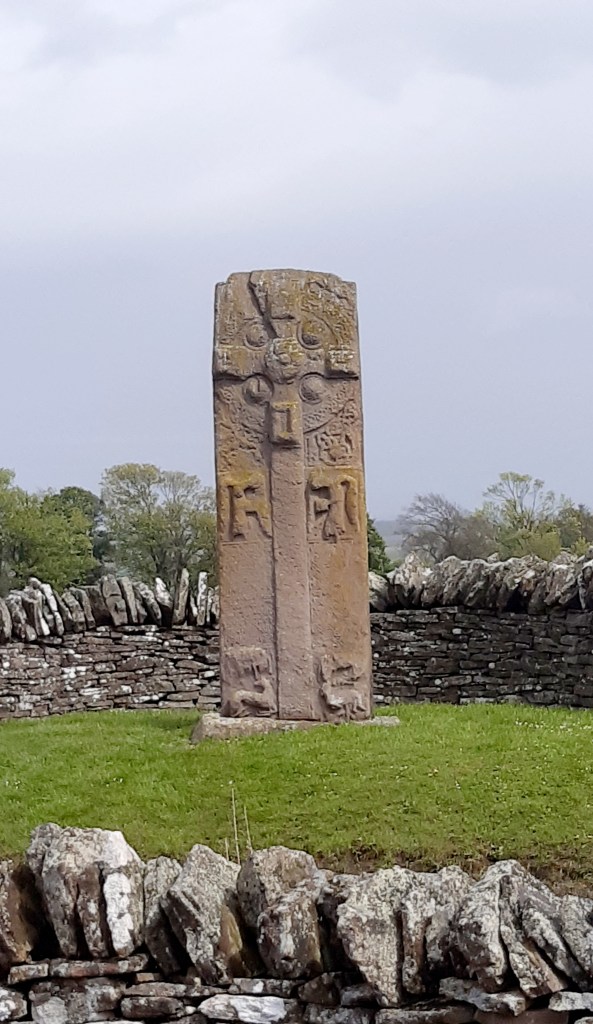
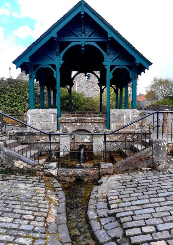
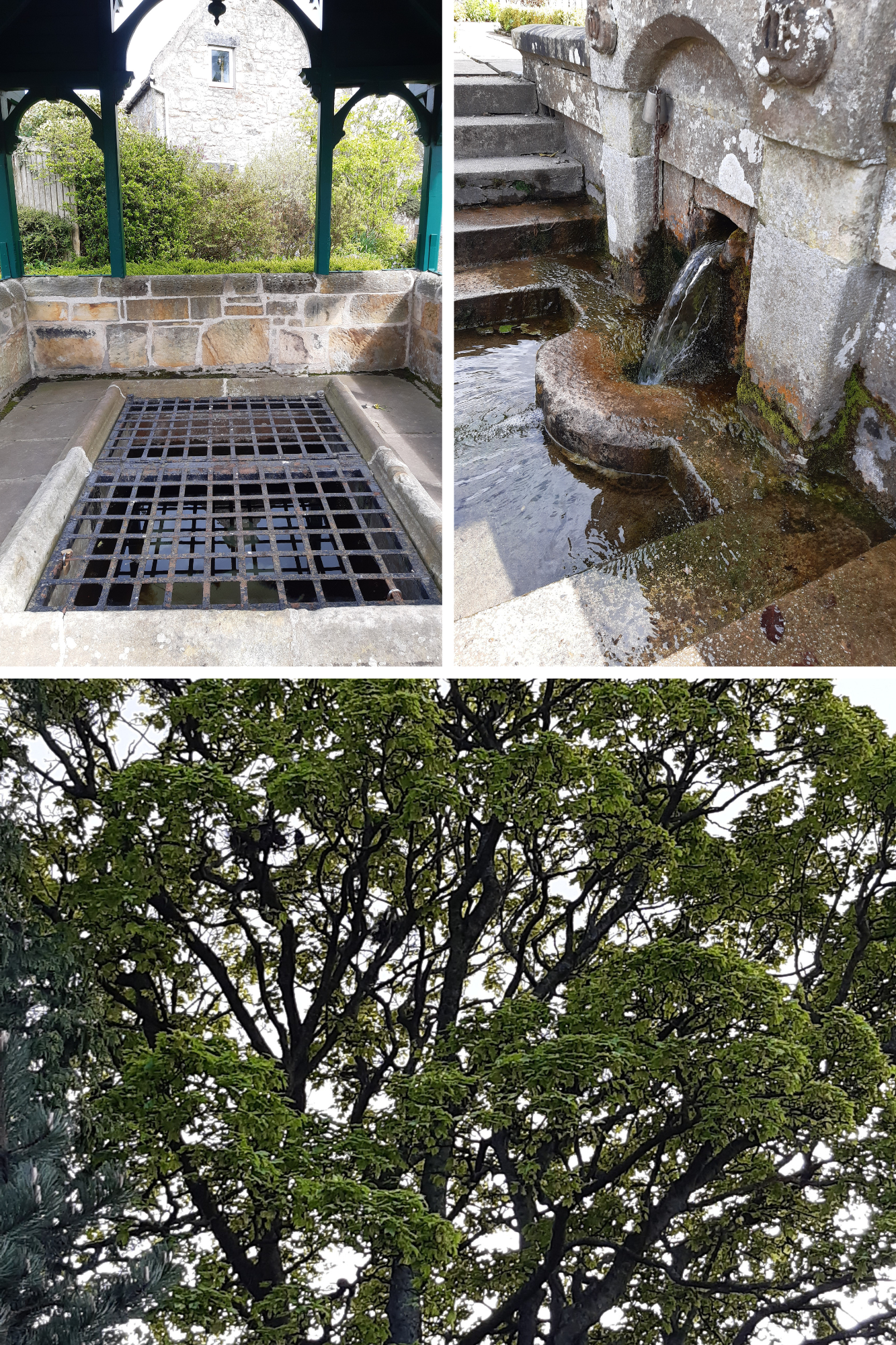
This isn’t actually an ‘earth house’ but an Iron-Age souterrain, a subterranean passage that was originally roofed over with stone slabs. A small room at the end of the chamber here had been created by a pair of huge, up-right slabs. It was discovered in 1871 while a local farmer was ploughing the field here. Souterrains can be found around Scotland’s eastern coast and built around 2,500 years ago, they would have been part of farming settlements made up of clusters of timber roundhouses. Souterrains seem to have been accessed from within a roundhouse built above, providing a cool dark place, most probably used for storing food. They would, however, have been vulnerable to dampness and vermin. They could also have been used as places of refuge if the settlement was under attack. As you can see from the stone-walling, this was skilfully built and may have incorporated a symbolic function. Here at Tealing, pre-historic rock art is carved into one of the huge stones by its entrance. The cup and ring marked stone perhaps represents the sun, the portal to a spirit world, even life itself, or life beyond this realm – eternity.
Excavation at Tealing found animal bones, shards of pottery, broken grinding stones for wheat and fragments of Roman glassware, the latter, suggesting trade routes with distant places. It could also mean this souterrain might still have been in use when the Romans passed through here. Only a few miles East of Tealing a further two Souterrains can be found – Ardestie & Carlungie while another, Culsh Earth House can be found near Tarland in Aberdeenshire.
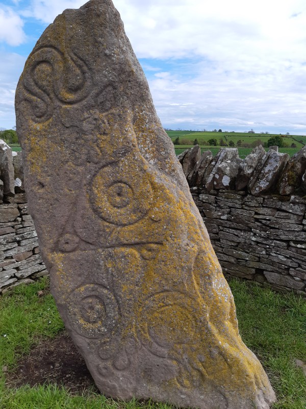
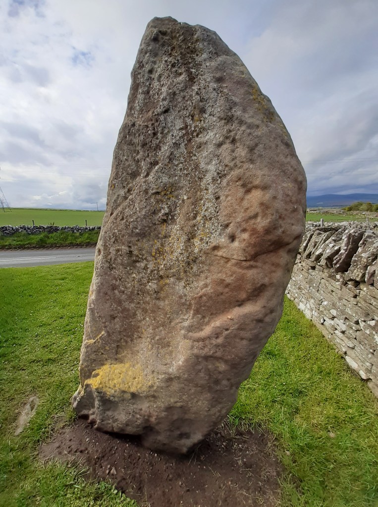
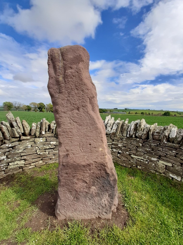
I was excited to come here on this wet and incredibly windy day to encounter a trio of remarkable remnants from our ancient past. AND what a way to begin my journey into Scotland’s pre-history! The Picts ruled much of Scotland during the Dark Ages, had a strong and distinct culture yet little is known of these warring and artistic people. Along the roadside in the village of Aberlermno are three magnificent Pictish stones bearing symbols from three graphic styles as their society evolved from Pagan to Christian worship.
The Serpent Stone – cup marks on the left side of this stone suggest that it was most probably a neolithic standing stone, reused by the Picts. This is a Class I stone, standing nearly 2m tall with carvings deeply incised and still clearly visible.
Class I stones – are natural rocks or boulders bearing incised Pictish symbols dating from the early bronze age. They bear no Christian images therefore likely carved before the arrival of St Columba and adoption of Christianity into Pictish culture.
This stone’s markings show a serpent above a double-disc and z-rod then a mirror and comb.
Serpent – throughout the World snakes have been associated with magic, death and rebirth, sex and healing.
Double Disk – perhaps represents two worlds: the here-and-now and the otherworld, life and death. Its has also been suggested that it signifies the marriage of two families. Z-Rod – this could represent someone whose spear was broken – dead – or who was a breaker of spears – a great warrior
Mirror & Comb – although on some stones the mirror is shown alone it is frequently thought to represent a woman. In the ancient world it has been used elsewhere as a symbol of the mother Goddess. Mirrors and combs also have magical connotations, appearing in folklore as enchanted objects
Whatever the meaning behind the symbols on this wonderful stone, they had a clear significance for the people who made them. The incisions are carbon dated at around 1500 years ago, elements of a lost hieroglyphical system used by the Picts for up to four centuries. They could represent a person of status within their community, mark a tribal location or make known tribal allegiance.
The Crescent Stone – only faint traces of a crescent marking and mirror remain on this Picitsh standing stone but nevertheless it still stands impressively alongside its neighbouring monoliths.
Crescent – having lunar associations, this could also represent the firmament. Often crossed with a v-rod (broken arrow), it’s one of the most common Pictish symbols.
Over these many centuries, such ancient monuments have eroded so that their stories are now completely lost to the wind and rain.
The Roadside Cross – standing in its original socket for over 1200 years, this stone is a Class II stone and testament to flourishing Christianity which had turned the Picts away from their Pagan religion within a mere 200 years of introduction. This impressive cross-slab was a declaration to the Glory of God.
Class II stones – these are shaped stones, carved in relief and almost always cross-slabs with Christian imagery and some traditional Pictish symbols.
The front of this stone has been deciphered as follows: Within a massive wheelhead cross there are Five circular bosses on the cross – possibly representing the wounds of Christ. Mourning Angels – holding gospel books.
The rear side: the top displays a Pictish symbol, the V-Rod – possibly the rising and setting of the sun/moon, then, below it there’s a Double Disk and Z-Rod – more elabourate than on the Serpent stone. A ceremonial hunt – with trumpeters below prominent Pictish symbols. David saving his flock from a lion – perhaps representing Christ the saviour. A centaur gathering medicinal plants – representing Christ the healer
These stones truly are incredible and although sitting by the roadside, each has been situated sympathetically in a small walled area to allow them to be viewed up-close. Grab your raincoat and go…!
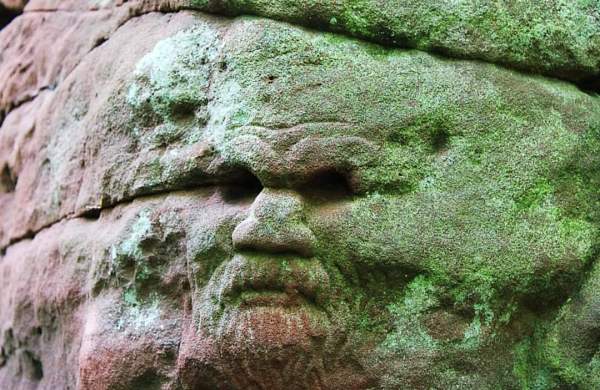
As I wandered into the grove beyond Dunino church, sunlight danced through the leaves of the trees surrounding Dunino Den, obscuring my vision. With a sudden fluttering of birds around me, I felt that there was indeed a supernatural atmosphere about this place. It’s said to be haunted by fairies, steeped in Celtic legend and a site of pagan worship that continues to attract pilgrims today. The fabled ‘Altar Stone’ sits up high, overlooking a burn running through the narrow gully below. A small, circular well worn into the rock here is rumoured to have once been used by Druids in their rituals of human sacrifice. Near the well, is a carved footprint, suggesting this was once a place of great significance. Carved footprints were used in Neolithic times, during inauguration rituals where our ancient chieftains would place a foot in such grooves and swear oaths to protect their people and lands. This would suggest that kings from our pre-history might once have been crowned here.
Steps lead down into the Den, to a Wheelhead Cross, ancient symbols and a mysterious face all carved in to the rock. Here, modern day worshippers now leave offerings, believing this place to be a portal to the otherworld. Ribbons flutter from the trees, messages for loved ones, since departed, are stuffed into cracks in the rock and coins left in crevices. Beware! It’s said that removing anything from this place will bring bad luck.
Legend tells of a visitor who came to Dunino Church and having followed the path through the woods to the altar stone, he saw an enchanting hamlet on the other side of the gully. The cottages were thatched and swathed in rambling roses. An old man in knee breeches and a woman in a long gown, stood at the entrance to one of the houses while a blacksmith leant on his hammer outside his workshop. A year later, the visitor returned, this time with a companion to whom he had recounted his story. They arrived at the Den to find the cottages gone and nothing but trees on the other side. It is said that a collection of cottages and a smithy once existed on the land there, but they had been demolished long, long ago….
“Come Faeries, take me out of this dull world, for I would ride with you upon the wind and dance upon the mountains like a flame!” – W B Yeats
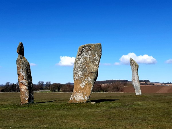
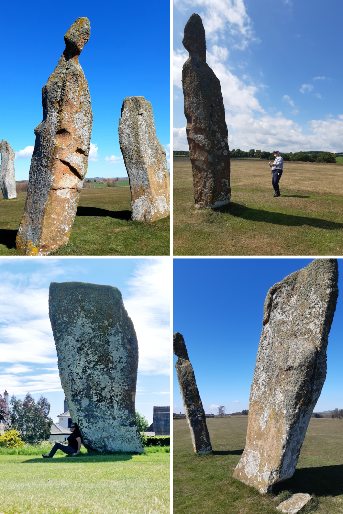
Where once where there were four, now there remains three very impressive, irregularly shaped, red sandstone megaliths. They are thought to have originally been part of the 16M circumference of a complete stone circle from the bronze age, 2000 – 1500BC. It’s said that the missing fourth stone had been broken by treasure hunters, the base remaining with the broken upper lying nearby until 1792. It was then moved by a farmer to allow for better ploughing of the field and was subsequently lost to memory.
A stone lined grave (cist) containing a skull was discovered near the Lundin stones in 1844. The skull, was given to Prof of Anatomy at Edinburgh University, Sir William Turner, who reported it had a metal arrowhead imbedded within a fracture but this crumbled to rust when it was touched. The discovery of the ‘ancient sepulchre’ draws parallels with other standing stone sites in Fife where human remains were also found.
Local folklore tells that the Lundin stones were memorials to Danish Chiefs who had been slain during a great battle here. However, these days the stones are witness to nothing more belligerent than golfing competitions as they present a magnificent feature on the second fairway of Lundin Links Ladies Golf Course.
The stone sitting south east, has a height of 4.2M with a slight northward incline. This one is heavily weathered, pitted with a large crack that has developed on its east side. The south stone is 4.6M in height and decidedly inclined southward. Lastly, the north stone is the tallest at 5.1M, having a slight incline westward. Bear in mind that in order for these stones to remain standing they will need be seated into the ground to equivalent lengths
I’ve come here many times with family or friends who’ve had an interest in Scotland’s ancient history and they’ve all been impressed with the magnitude of the Lundin Stones and the fact that they still remain after all this time. If you decide to visit, please be polite by asking at the Club House if it’s safe to walk to the stones as there may be golfers about to tee off. Be sure to also skirt the course on your way to and from the site. A blow to the head with a golf ball could mean your skull might be the next to leave here with a fracture!
The natural spring water that bubbles up from deep underground and through the sand in the cistern of this well has a history mingled with folklore. It has been renowned for its curative properties for centuries and was first named ‘Fons Scotiae’ (Well of Scotland) by the Romans who passed through this area in 1st century AD.
The widespread assertion that the water had healing powers meant that Scotlandwell became a significant place of pilgrimage throughout the Medieval period.
Around 1250, the Trinitarian Friars (aka Red Friars) moved here to establish a hospice, using the healing waters from the holy well for patients in their new hospital of St Mary. It’s said that in the early 14th century, King Robert the Bruce came here in the hope of a cure for his leprosy and records show that Charles II travelled from his Palace in Dunfermline to take the ‘curative’. Mary Queen of Scots is also known to have visited the well to partake of its exquisite water.
The lovely, ornamental structure which now houses this ancient well is built from local sandstone, put in place and completed in 1858 by mason, Thomas Hay, and the wooden canopy constructed by joiner, Alexander Kelloch of Lindores. The reconstruction of the well, building of an adjacent wash house and drying green was benefacted to the local community by landowner, Thomas Bruce of Arnot and his wife Henrietta Dorin, at a cost of £154. Quite a tidy sum at the time.
I stop by here often to sit in the peacefulness of this place, drink the water and listen to the cascading of the water as it streams out of the well spout….if it’s not drowned out by the squawking of hundreds of crows that live in nearby sycamore trees.
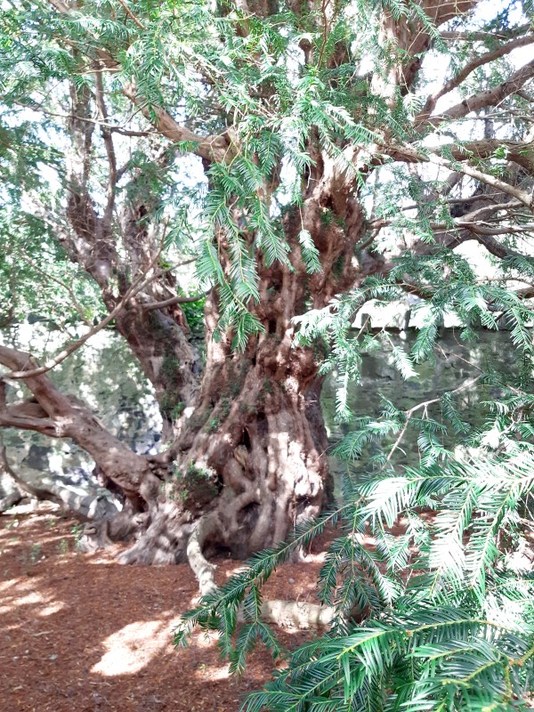
Just a short scenic drive from Loch Tay, in the hamlet of Fortingall, resides Europe’s (and possibly the World’s) oldest living thing. It’s estimated that the roots of this tree weave back over 5,000 years. Under a veil of coniferous needles you can see the relic trunks of what was once a huge, ancient Yew Tree. In 1769 the tree had a girth of approximately 56ft (17m) but sadly as a result of rapacious souvenir hunters, large sections of the yew were ‘appropriated’. Although sitting within the grounds of Fortingall churchyard, a new enclosure which it now occupies, had to be built to stop the tree from being completely destroyed.
Before the arrival of Christianity, the Yew was known as the tree of eternity. At around 500 years old, when most trees have died, Yews start to grow again. This otherworldly power led early people to revere the Yew and the Fortingall Yew Tree may have marked a place of worship for them. Archaeological evidence indicates this area has been inhabited for more than 5,000 years and three groups of standing stones and numerous large, cupmarked stones from that timeline can be found nearby. As with many ‘pagan’ sites, when early Christians arrived at Fortingall in the 7th century, they built their new church next to the Yew.
Over subsequent centuries, Yew trees continued to be cultivated within the enclosed grounds of Churches throughout Britain because although the Yew is toxic to livestock, the wood from these trees was best for producing longbows.
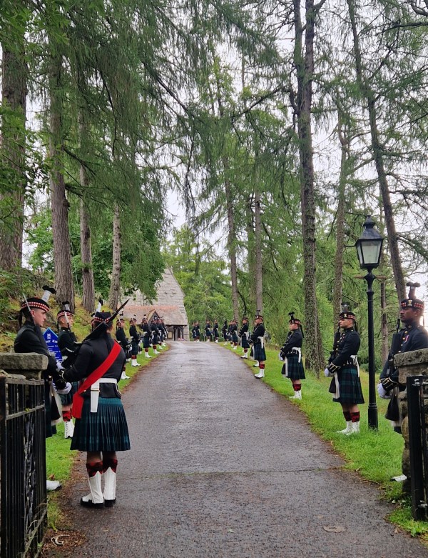
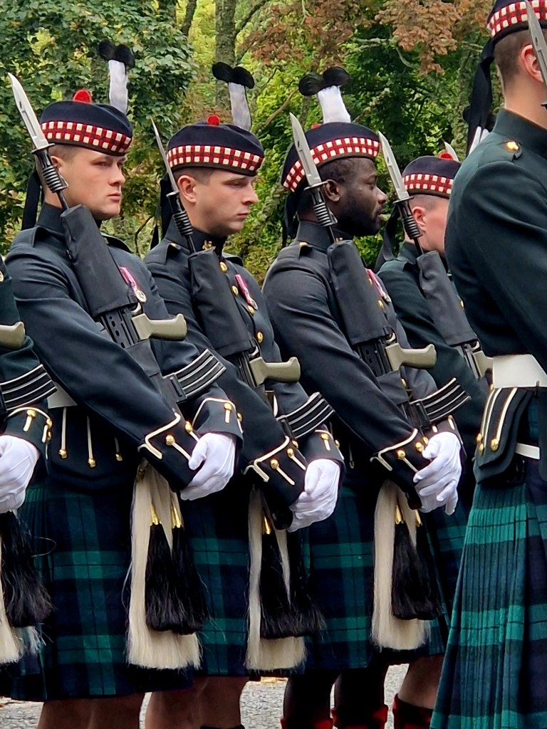
Fortuitously, I was in a café in Ballater when I heard this event would be taking place and as I was only a 15 minute drive away I thought I’d go along to watch the proceedings.
Balaklava Company, 5th Battalion of the Royal Regiment of Scotland, forms a Guard of Honour at Crathie Kirk to welcome members of the Royal Family. The British Royal Family have worshiped here at Crathie for over a century. While they are an independent rifle company, Balaklava Company are renowned for their ceremonial role in Scotland and remain on Royal Guard at Balmoral for the duration of the Monarch’s summer stay there.
Balaklava Company participated in ceremonies to escort the late Queen, Elizabeth II, in her coffin from Balmoral to Edinburgh then onward to London. They were also involved in her funeral. Lieutenant General, Nick Borton, said “It’s a deeply personal attachment for all the soldiers in the regiment to be involved in her funeral arrangements,” he said. “She was very fond of the regiment and all the soldiers in it. For us, it’s not just a military task, we’re saying goodbye to our Commander in Chief and our Colonel.”
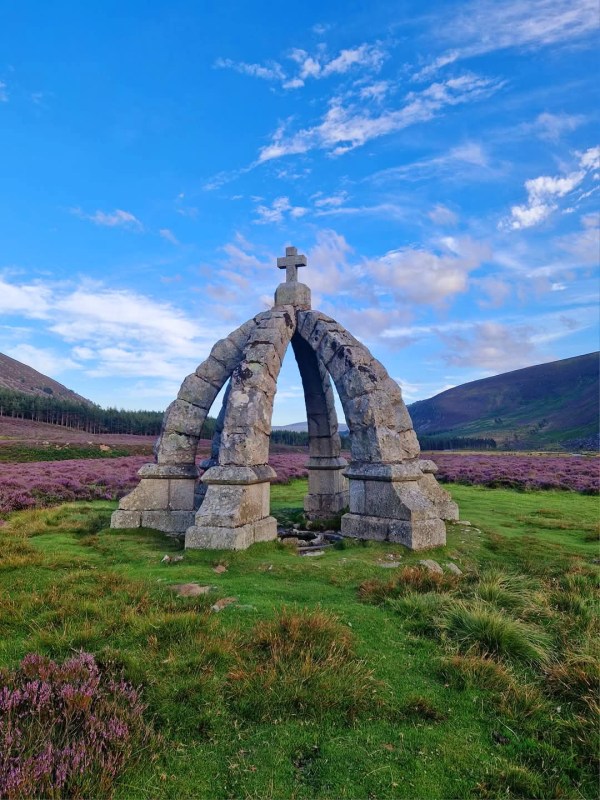
A 4mile (6.4Km) roundtrip ‘stroll’ will take you from Invermark to the magnificent ‘Queen’s Well’ in Glen Esk. The route is strewn with boulders so presents a bit of a challenge in places, however, certainly worth the effort as the scenery is spectacular, especially when the heather is in full bloom.
This granite crown shaped monument sits over a natural spring originally known as the ‘White Well’. The stone well was erected by Lord Dalhousie in 1861 to commemorate a visit made there by Queen Victoria and Prince Albert earlier that year. During their annual sojourn at Balmoral, the Royal couple and their entourage rode the 15mile (24Km) trip on ponies from Bridge of Muik, stopping for a picnic along the way. They met with Lord Dalhousie at the White Well where they refreshed themselves with the spring water before heading off to spend the night at his home, Invermark Lodge.
The inscription at the monument reads – ‘Her Majesty, Queen Victoria, and his Royal Highness the Prince Consort, visited this well and drank of its refreshing waters, on the 20th September, 1861, the year of Her Majesty’s great sorrow.’
Albert died on 14th December 1861, aged 42 years, having been diagnosed with typhoid fever.