Arbroath Abbey, Arbroath – Angus

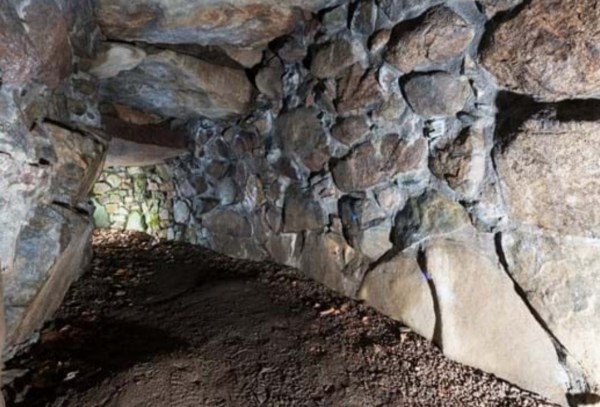
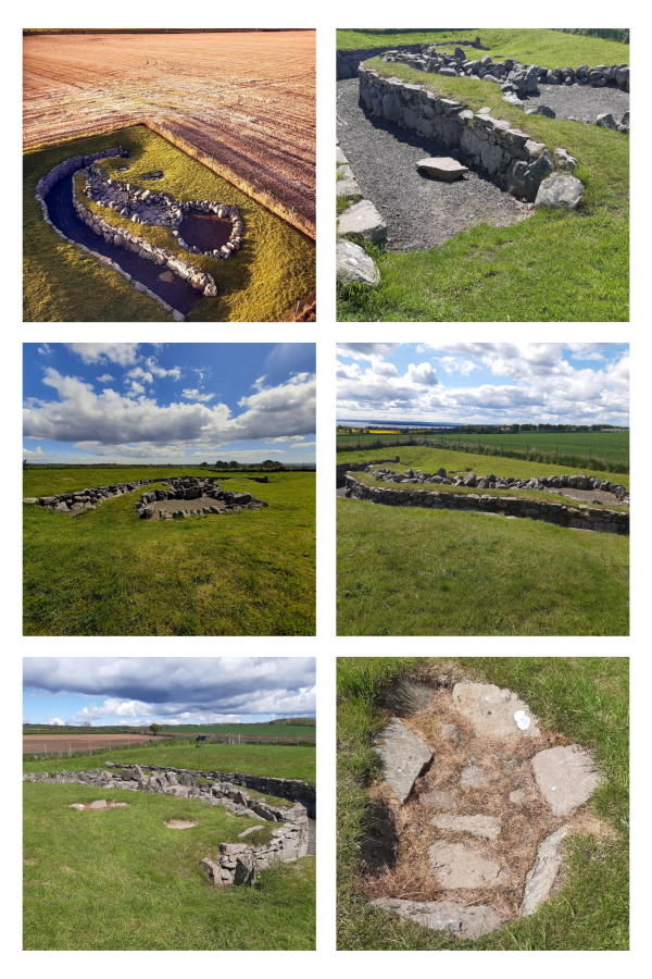
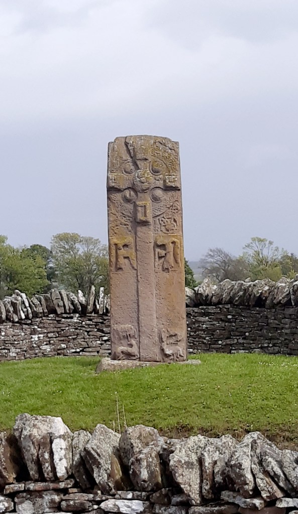
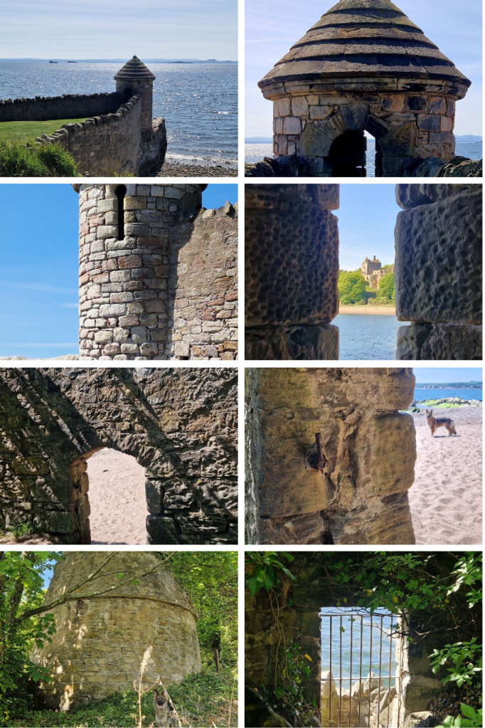
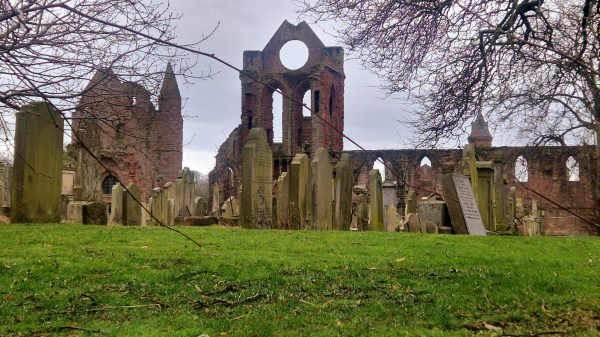
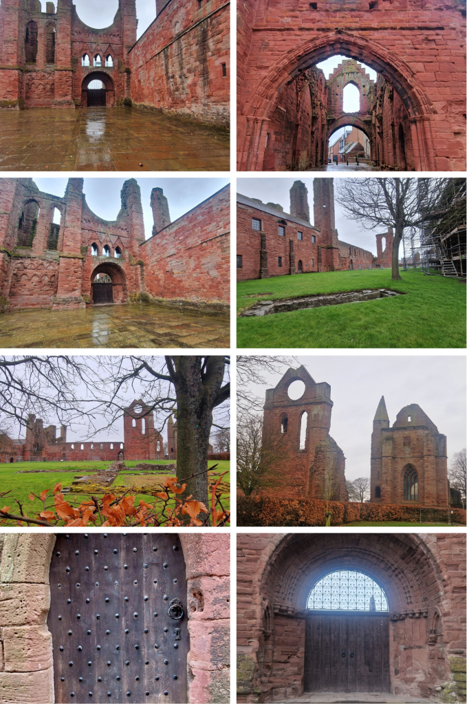
As you walk into the heart of the city of Arbroath, you get a feeling of the enormity that this Abbey once was. Impressive parts of this red sandstone cruciform Church still survive, the west end, south transept & sacristy, the gatehouse and the Abbot’s house which is now the museum. The cloister and other buildings are now ruinous but their foundations are still apparent and there’s also a large cemetery within the grounds.

Arbroath Abbey was founded in 1178 by King William (1st), the Lion, for the Tironensian Benedictin Monks from Kelso Abbey. King William bestowed considerable lands and great wealth upon the Abbey as well as custody of the Monymusk Reliquary, the casket believed to contain the relics of St Columba. It’s believed that he had the Abbey built in memory of his murdered dear friend, Thomas Becket (St Thomas the Martyr) and in the hope of currying favour with God for his own safety. William had been captured by English forces at the Battle of Alnwick in 1174 and only released by King Henry II a year later after being forced into signing the Treaty of Falaise which acknowledged Henry as William’s feudal superior. William was eventually buried here in 1214.

The Declaration of Arbroath, asserting Scottish independence over English aggression, was signed here in 1320. The original document is in the keeping of National Records of Scotland however a copy can been seen in the abbey’s museum. In 1951 a group of students stole back Scotland’s Stone of Destiny from Westminster Abbey. It had been seized in 1296 by Edward I of England from Scone Palace (nr Perth) where all Scottish Kings were crowned upon it. Edward took the stone to demonstrate his power over Scotland. It was used in the coronation of British monarchs thereafter however this was hugely resented by Scots. The students eventually placed it at the High Alter of Arbroath Abbey. The Stone of Destiny is now currently on display at Perth Museum.

In the 1800’s Arbroath’s huge fishing fleet would look for the massive round window of the Abbey’s south transept gable to guide them home from the open sea. A red beacon fire was lit at the iconic window and this practice gave the people from Arbroath the nickname of ‘Red Lichties’ (red lights).

Claypotts Castle – Dundee

In the West Ferry area of Dundee, you’ll find the fairy-tale-like Claypotts castle. This curious and striking castle comprises a Z-plan Tower House, built as a family home by John Strachan and his son over two decades in the 1500’s and was, at that time, surrounded by several outbuildings and farm land. It consists of a rectangular main block, two large round towers and crowned with square gabled chambers at opposite corners. The round towers and diagonal corners meant that any attackers could easily be spotted.

The lands at Claypotts had originally been owned by Lindores Abbey and as the name ‘Claypotts’ suggests it was used by the Abbey as the location for their pottery production around 1247. By the early 1500’s the land had passed to John Strachan when he married Eufame Durham. Their servants included Jonet Wilkie, who worked for them here for over 14 years, Margaret Swynton who was house keeper and responsible for supervising the other servants and it’s known she earned a salary of six pounds a year. A male servant, George Tailyour was the family porter who answered the door and took care of all the candles and lighting. Eufame lived here all of her married life until her death in 1580. Her will still exists and lists property including her brown riding horse and 15 oxen for ploughing.

The Castle was sold to the Grahams in 1620. John Graham, 7th Laird of Claverhouse & 1st Viscount of Dundee, inherited Claypotts in 1653 when he was only 4 years old. Claverhouse was a professional soldier and gained a reputation as ‘Bluidy Clavers’ because of his enthusiastic persecution of Covenanters in Galloway. He became a prominent character during the Jacobite rebellion, earning himself the nickname ‘Bonnie Dundee’ (and by all accounts he was a very handsome fellow – see image below) by his supporters after he was shot and fell from his horse, mortally wounded, leading the Jacobites to victory over the forces of King William III & Queen Mary II at the battle of Killiecrankie in 1689. He was buried 3 days later in the mausoleum at St Brides Kirk, Old Blair. His lands were forfeited in 1694 and passed to Douglas, Earl of Angus, when the Jacobean cause was lost, then latterly passing to the Horne family. Thereafter the castle fell into a dilapidated condition but continued to be lived in by farm labourers until the late 19th century.

Claypotts finally fell into State care in 1926 when the surrounding buildings were demolishing and eventually replaced by incongruous modern housing. I felt sad to find this lovely, quirky castle sitting cheek by jowl with such dreary buildings.

It’s said that Claypotts is haunted by the spirit of a ‘White Lady’. This ghostly apparition is thought to be Marion Ogilvie, long-term mistress of Cardinal David Beaton and there is also an eerie legend that John Graham of Claverhouse still haunts the rooms of the castle.

The Castle Grounds are open all year however access to the Claypotts Castle itself needs to be arranged via Historic Scotland – 0121 878 756

Tomnaverie Stone Circle, Tarland – Aberdeenshire

I happened upon this stone circle when I’d come to find nearby Culsh Earth House. Thought to have been built around 5,000 years ago, this is one of several stone circles unique to the north-east of Scotland as it has a recumbent stone. Framed by the recumbent stone the stones flanking either side, the focus of this circle seems to have been Lochnagar, the prominent mountain 20 miles(32km) south-west of here. The Neolithic people who built this circle would have used it to mark the movement of the Moon throughout the year. They undoubtedly linked the landscape and the stars with their spiritual life and would have revered this site as a place of worship. Set upon this wee hill at the centre of these flatlands known as ‘the Howe’, it’s likely that other communities and their stone circles would also have been visible from here.

The centre of this particular circle, surrounded by kerb stones, is known to have been used for cremation pyres. A mound of charcoal, burnt soil and bone was excavated from the centre here in the 1990’s.

Culsh Earth House, Tarland – Aberdeenshire

Built about 2,000 years ago, and despite its name, it was not a dwelling, but a 15m stone-lined, underground passage. This Iron Age larder is one of the most complete examples of its kind.

Culsh earth house survives as it was over 2,000 years ago and is one of only a few souterrains in Scotland  that can safely be accessed. We don’t know what it was used for – perhaps a storage space, potentially a hiding place, or as two cup-marked stones inside may indicate it may have had some ritual significance. From the outside this souterrain appears to be just a bump in the ground therefore it would not have attracted any attention, It could, however, be entered both from within the round-house built above it and from the concealed outside entrance.

Check out other examples of Scottish souterrains such as those at – Tealing, Ardestie and Carlungie.

Carlungie Earth House – Angus

At about 40m long, Carlungie Earth House is one of the largest and most complex examples of its kind in Scotland. It was accidentally discovered during ploughing in 1949 and subsequent excavations during the following two years revealed a further eight associated stone dwellings at ground level.

Earth houses, or souterrains as they are also known, were once thought to have been defensive refuges but it’s now considered that they were in fact cellars, as their cool environment would have made them suitable for storing grain, dairy products and meat. These stone-lined underground passages typically date to the Iron Age and have been found along much of eastern Scotland, as well as in Ireland, Cornwall and Brittany. Just a few miles away can be found Ardestie and Tealing ‘earth houses’ and farther north Culsh Earth House just outside Tarland, Aberdeenshire.

Ardestie Earth House – Angus

The remains of Ardestie Iron Age souterrain was uncovered during stone clearance in 1949. Structures like this formed part of many Iron Age farming settlements north of the River Forth, sometime between 2,800 & 1,500 years ago. Life here centred around farming so the use of these souterrains may have been for storing grain and other goods however they were vulnerable to dampness and vermin. This souterrain was adapted after it was built, by putting in a stone lined drain to combat its poor drainage.

Souterrains such as this were skilfully built and often had cup marks and symbols on some of the stones. It could possibly mean that they also had a ritual function such as for rites of passage.

If you have an interest in these ‘earth houses’, you can visit others nearby at Carlungie and Tealing, then further north Culsh Earth House by Tarland in Aberdeenshire

The Aberlermno Stones – Forfar

I was excited to come here on this wet and incredibly windy day to encounter a trio of remarkable remnants from our ancient past.  AND what a way to begin my journey into Scotland’s pre-history!  The Picts ruled much of Scotland during the Dark Ages, had a strong and distinct culture yet little is known of these warring and artistic people.  Along the roadside in the village of Aberlermno are three magnificent Pictish stones bearing symbols from three graphic styles as their society evolved from Pagan to Christian worship.

The Serpent Stone – cup marks on the left side of this stone suggest that it was most probably a neolithic standing stone, reused by the Picts. This is a Class I stone, standing nearly 2m tall with carvings deeply incised and still clearly visible.

Class I stones – are natural rocks or boulders bearing incised Pictish symbols dating from the early bronze age. They bear no Christian images therefore likely carved before the arrival of St Columba and adoption of Christianity into Pictish culture.

This stone’s markings show a serpent above a double-disc and z-rod then a mirror and comb.

Serpent – throughout the World snakes have been associated with magic, death and rebirth, sex and healing.

Double Disk – perhaps represents two worlds: the here-and-now and the otherworld, life and death.  Its has also been suggested that it signifies the marriage of two families. Z-Rod – this could represent someone whose spear was broken – dead – or who was a breaker of spears – a great warrior

Mirror & Comb – although on some stones the mirror is shown alone it is frequently thought to represent a woman. In the ancient world it has been used elsewhere as a symbol of the mother Goddess.  Mirrors and combs also have magical connotations, appearing in folklore as enchanted objects

Whatever the meaning behind the symbols on this wonderful stone, they had a clear significance for the people who made them.  The incisions are carbon dated at around 1500 years ago, elements of a lost hieroglyphical system used by the Picts for up to four centuries.  They could represent a person of status within their community, mark a tribal location or make known tribal allegiance.

The Crescent Stone – only faint traces of a crescent marking and mirror remain on this Picitsh standing stone but nevertheless it still stands impressively alongside its neighbouring monoliths.   

Crescent – having lunar associations, this could also represent the firmament. Often crossed with a v-rod (broken arrow), it’s one of the most common Pictish symbols.

Over these many centuries, such ancient monuments have eroded so that their stories are now completely lost to the wind and rain.

The Roadside Cross – standing in its original socket for over 1200 years, this stone is a Class II stone and testament to flourishing Christianity which had turned the Picts away from their Pagan religion within a mere 200 years of introduction.  This impressive cross-slab was a declaration to the Glory of God. 

Class II stones – these are shaped stones, carved in relief and almost always cross-slabs with Christian imagery and some traditional Pictish symbols.

The front of this stone has been deciphered as follows:  Within a massive wheelhead cross there are Five circular bosses on the cross – possibly representing the wounds of Christ.  Mourning Angels – holding gospel books.

The rear side:  the top displays a Pictish symbol, the V-Rod – possibly the rising and setting of the sun/moon, then, below it there’s a Double Disk and Z-Rod – more elabourate than on the Serpent stone.  A ceremonial hunt – with trumpeters below prominent Pictish symbols. David saving his flock from a lion – perhaps representing Christ the saviour. A centaur gathering medicinal plants – representing Christ the healer                                    

These stones truly are incredible and although sitting by the roadside, each has been situated sympathetically in a small walled area to allow them to be viewed up-close.  Grab your raincoat and go…!

Ravenscraig Castle, Dysart – Fife

Now ruinous, Ravenscraig Castle belonged to one of the most powerful women in Scottish history, Queen Mary of Guelders, wife of James II.  Mary was descended from one of Europe’s most prominent families and had been raised at the court of her great-uncle, The Duke of Burgundy. She arrived in Scotland in June 1449, first visiting the Isle of May to pray at the shrine of St Adrian before making her way to Leith and staying at the Convent of St Anthony. On her wedding day, on 3 July 1449, crowds of commoners and nobles lined the streets of Edinburgh to watch her make her way to Holyrood Abbey for her marriage to King James II of Scotland. She was 14 and he was 18.

In 1460 King James gave his wife the land here at Dysart to build a castle but he was killed just a few months later. James had witness the introduction of gunpowder and was fascinated with artillery so the Duke Of Burgundy gifted him Mons Meg (this still sits on the parapet of Edinburgh Castle to this day). Mons Meg is a massive, iron cannon which took a team of oxen to move, constantly became stuck because of its enormous weight and could travel no farther than 5km a day. As Roxburgh Castle had long been held by the English, King James ordered some special new cannons from Flanders to ensure success in his bid to retrieve Roxburgh. During the siege, he stood proudly beside one of his new cannons, The Lion, and ordered it to be fired. One of the cannons iron rings had worked loose during transportation and it exploded, sending a piece of iron slicing through the King’s thigh, cutting it in half. He bled out quickly and was dead within minutes. King James was 29 years old. Roxburgh castle fell to James’ forces a few days later.

The death of King James left Mary to rule over the Kingdom as regent, on behalf of their young son James III.  She was only in her mid-twenties when she took over governance of Scotland and ordered the construction of Ravenscraig Castle. Ravenscraig was built as a fortress to guard the Firth of Forth and the first in Scotland erected to withstand return artillery fire. The Castle consists of two D-plan towers with 3.5m thick walls, linked by a two-storey block with a broad parapet and gun loops for safely firing upon attackers. The courtyard is cut off from the surrounding area by a very deep ditch and could be reached only by drawbridge. Building this Castle was a huge undertaking and the Queen employed master of works, David Boys, to lead a team that included master carpenter, Andrew Lesouris, and master mason Henry Merlzioun. Between 1461 & 1462 more than £600 had been spent. The construction, however, was interrupted when Mary died at Ravenscraig, just three years after her husband in 1463.

King James III wasn’t interested in Ravenscraig so made William Sinclair, who at the time was 1st Earl of Caithness and Norse Earl of Orkney, exchange his fiefdom of Kirkwall Castle on Orkney for Ravenscraig Castle in Dysart in 1470.  At that time, only three storeys of the east tower and the foundations of the adjacent hall were complete. Sinclair continued the building, altering the original design and had a gun platform constructed where Queen Mary’s great hall had been planned. It was to be a self contained residence with a bedroom on the top floor, the great hall below, then public areas, a bakery and other outbuildings filled the promontory. The gun platform was located between the two towers with cellars underneath. Ravenscraig Castle is known to have protected Merchant Ships from pirates who were based on the Isle of May in the outer part of the Forth Estuary.

Built eastward along the shore from Ravenscraig, high walls protected against would-be invaders. A watchtower is built into the wall from which guards would have seen vessels coming & going from all directions. A gateway through the wall would have allowed for the delivery of goods, although this originally had a secure iron gate. A beehive dovecot from the 16th century also remains. The pigeons housed within would have been an important source of meat and eggs during tough winter months. The land around the castle is now parkland, ‘Ravenscraig Park’, once known as ‘Three Trees Park’. Legend tells that three brothers of the Sinclair family mistook each other as robbers one dark night and shot each other dead. Trees were planted over their graves.

Ravenscraig Castle remained in the Sinclair family until 1898 when it was sold to local linoleum manufacturer, Sir Michael Nairn, then finally taken into State care in 1955 due to its decayed and dangerous condition. Some parts of the Castle are still accessible to visitors but, disappointingly, the stairway to the remaining upper level is now locked behind an iron gate. Millie & I scrambled around trying to take photos but they don’t do justice to the size and might of this once proud Castle, built here in this prominent position overlooking the Firth of Forth.

NB: Notably, William Sinclair also had Rosslyn Chapel built.

Dunino Den – Fife

As I wandered into the grove beyond Dunino church, sunlight danced through the leaves of the trees surrounding Dunino Den, obscuring my vision. With a sudden fluttering of birds around me, I felt that there was indeed a supernatural atmosphere about this place. It’s said to be haunted by fairies, steeped in Celtic legend and a site of pagan worship that continues to attract pilgrims today. The fabled ‘Altar Stone’ sits up high, overlooking a burn running through the narrow gully below. A small, circular well worn into the rock here is rumoured to have once been used by Druids in their rituals of human sacrifice. Near the well, is a carved footprint, suggesting this was once a place of great significance. Carved footprints were used in Neolithic times, during inauguration rituals where our ancient chieftains would place a foot in such grooves and swear oaths to protect their people and lands. This would suggest that kings from our pre-history might once have been crowned here.

Steps lead down into the Den, to a Wheelhead Cross, ancient symbols and a mysterious face all carved in to the rock. Here, modern day worshippers now leave offerings, believing this place to be a portal to the otherworld. Ribbons flutter from the trees, messages for loved ones, since departed, are stuffed into cracks in the rock and coins left in crevices. Beware! It’s said that removing anything from this place will bring bad luck.

Legend tells of a visitor who came to Dunino Church and having followed the path through the woods to the altar stone, he saw an enchanting hamlet on the other side of the gully. The cottages were thatched and swathed in rambling roses. An old man in knee breeches and a woman in a long gown, stood at the entrance to one of the houses while a blacksmith leant on his hammer outside his workshop. A year later, the visitor returned, this time with a companion to whom he had recounted his story. They arrived at the Den to find the cottages gone and nothing but trees on the other side. It is said that a collection of cottages and a smithy once existed on the land there, but they had been demolished long, long ago….

“Come Faeries, take me out of this dull world, for I would ride with you upon the wind and dance upon the mountains like a flame!” – W B Yeats

Up Helly Aa, Lerwick – Shetland

Shetland and Orkney had been domain of the Vikings from around 850 AD. In 1469 however, Princess Margaret, the 13 year old daughter of King Christian I of Denmark & Norway, was betrothed to King James III of Scotland. Her dowry was set at 6000 Guilders yet King Christian could only come up with 2000 Guilders therefore Shetland & Orkney were offered as security for the rest. The outstanding amount was never realised, so, on 20th February 1472 via an act of Parliament, both Orkney and Shetland officially became part of Scotland. Gradually Scottish culture spread throughout the islands but Norse customs and the Old Norse language have remained routed in the identity of the islanders over these many centuries. While Norse words and names are still evident the most discernible characteristic of Viking heritage are the Up Helly Aa events held throughout the Shetland archipelago from January to March every year.

The Up Helly Aa tradition began in the mid 19th century and gradually evolved into the annual festival we witness today, with many aspects still echoing the Viking celebrations of 150 years ago. Islanders are very much involved in the event and need to have been resident in Shetland for at least five years before they can even participate in a squad and the procession. To be Guizer Jarl, a member must have served at least 16 years on the committee.

The building of the Viking Galley, making Viking costumes and the thousands of torches are done by volunteers and the Jarl Squad, working tirelessly throughout the winter until everything is ready. The reveal of the Galley and the Jarl Squad is kept a secret until the big day when they step out for the first time to start the Up Helly Aa morning parades.

The evening procession incorporates 46 additional squads dressed in a variety of themes with performances choreographed in preparation for the after event parties. When darkness has descended, the squads assemble at 7pm to the sound of a Pipe Band after which the Guizer Jarl and his squad are ushered forward to the head of the parade with their Viking Longboat in tow, accompanied by the local Brass Band. All other squads then follow, marching behind them and through the town until finally reaching the Playing Field, circling the perimeter before heading to the Burning Site where the magnificent replica longboat is torched. This burning of the Galley signifies the end of the Yule period, in legendary Viking style, of course!

The festivities then move to many community halls where locals and visitors party through the night, dancing to Scottish Country Music and lapping up the entertainment provided by the guizer squads.

This celebration of Shetland’s Viking heritage is a festival unlike any other in the World. It truly is a community event with Lerwegians exuding immense pride in their uniquely special day and we found everyone to be incredibly welcoming and friendly. If you have a list of adventures you’d like to fulfil, I can highly recommend Up Helly Aa is on it!

Blog at WordPress.com.

Up ↑