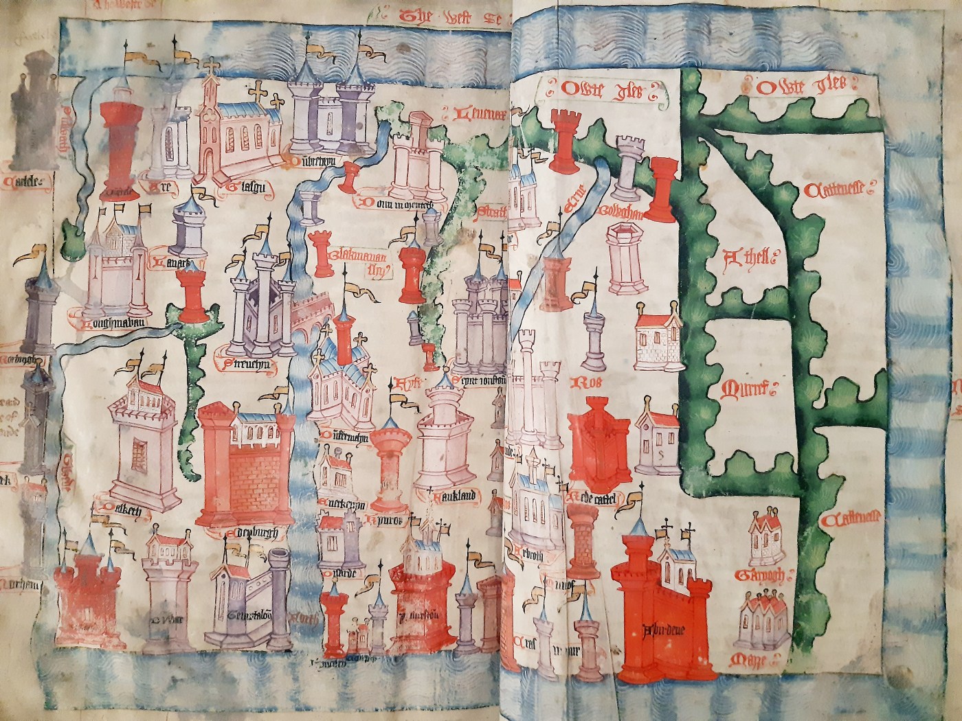
This outstanding map shows Scotland as an inviting and wealthy Country with great cities, walled towns, majestic castles and grand churches. Presented to King Henry VI of England in 1457 by chronicler, John Hardyng, it was done so as an enticement for the King to invade Scotland.
Hardyng had originally been sent as a spy on a secret mission to Scotland by Henry V (1413-1422) who intended to invade. However, Henry V died so the map became part of Hardyngs first chronicle, ‘A History of England and its Neighbours’. Hardyng suggested a route England’s army could take to invade Scotland.
The Map was being displayed at Wardlaw Museum, St Andrews, while on loan from the British Library, so I took the opportunity to pop by to see it. Being a fan of using maps to find my way around rather than relying on GPS, I was intrigued to see this. It’s not everyday you can have a close up look at something that’s almost 800 years old!
